
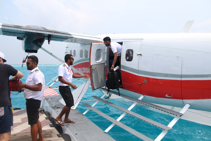
Today, I start another exciting journey to the southern part of the Maldives, Dhaalu atoll, where I will be spending two weeks at the island of Velavaru. The marine lab at Velavaru has lots of work on its hands, I’ve heard that the rope nursery for the corals is doing super well and there’s lots of live coral around the reefs…so that makes for a lot of coral planting! To get to Dhaalu atoll, you have to take a seaplane flight from the airport at Hulhumale. Seaplanes are strange. They remind me of something out of an action movie…or a war film or something.
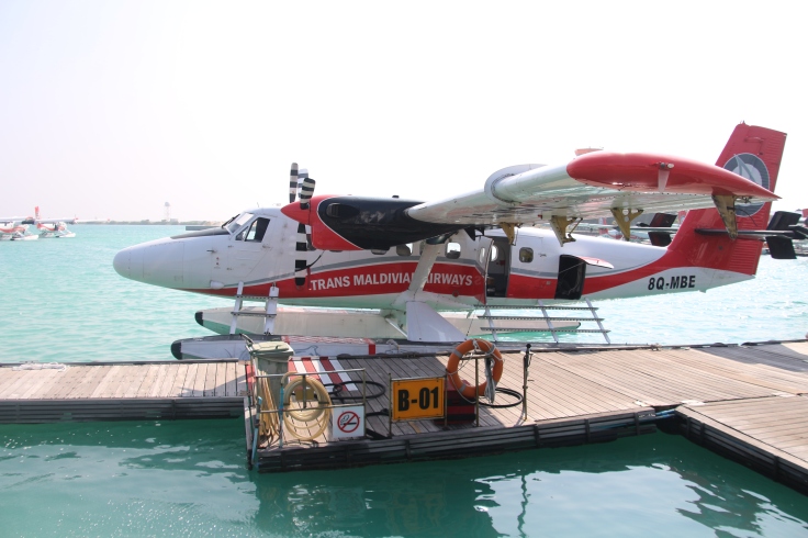
Waiting for my flight at the seaplane terminal and watching the rest of the planes take off!
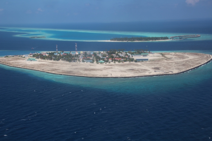
I snag a seat right at the window next to the propellers and watch as I see Hulhumale and Male shrink from a distance. It’s strange to think that when people think of the Maldives, they think of white sandy beaches, coconut palms and resorts, but this is also Maldives. Male is one of the most densely populated cities in the world, with an area shy of six square kilometres and a population exceeding 133’000 people. That’s actually just slightly larger than Sentosa which is around five square kilometres!
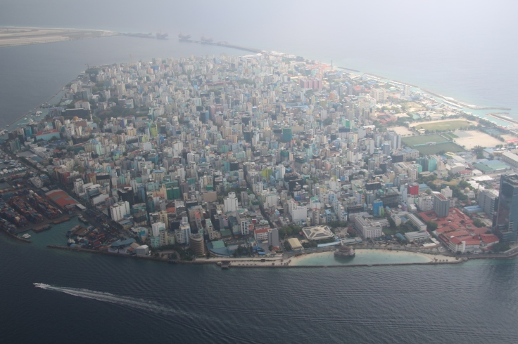
View of Male from the sea plane
The Maldives was a name thought to be derived from a few languages, namely Sanskrit mālādvīpa (मालाद्वीप), Malayalam Maladweepu (മാലദ്വീപ്), Tamil Malai Theevu (மாலைத்தீவு) and Kannada Maaledweepa (ಮಾಲೆದ್ವೀಪ), but they all mean something similar “garland of islands”. Also a side note…it’s pronounced Mall + Deeves, not Mall + Dives, though the latter seems to make sense since lots of diving happens in the Maldives. After taking my first sea plane flight in the Maldives, it’s easy to see how the country got its name.
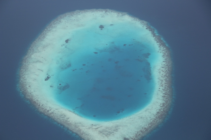
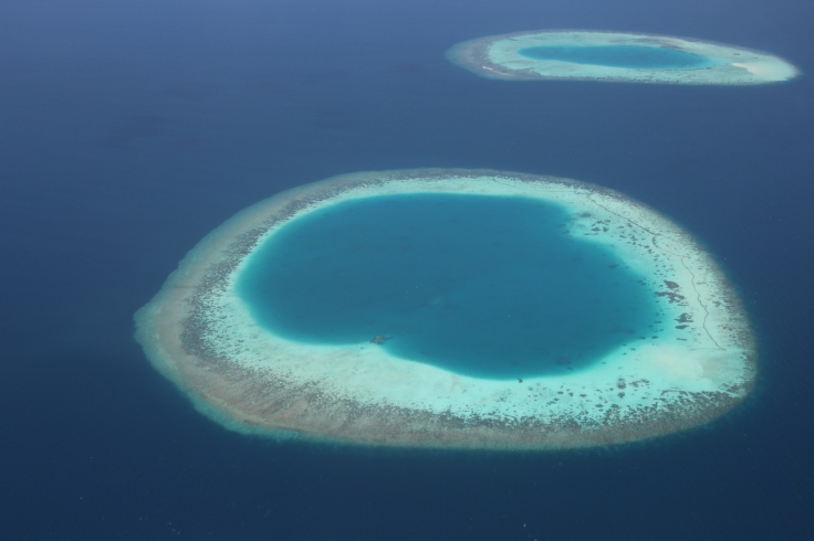
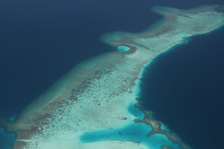
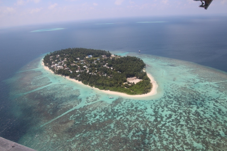
It’s amazing to see the Maldives from the air, every single ring after ring of microatolls and reefs. The Maldives is a nation of around 1190 islands, of which around a tenth is inhabited. This is the lowest lying country in the world— Maldivian islands have an average height barely 1.5m above sea level, and with sea levels rising as a result of climate change, it is expected that an 80cm rise by 2100 will flood a significant portion of the country.

These natural formations have Funnily enough, the first time I encountered the word ‘atoll’ was in what is now one of my favourite poems, “Bearded Oaks”, by an American poet, Robert Penn Warren.
The oaks, how subtle and marine,
Barded, and all the layered light
Above them swims; and thus the scene,
Recessed, awaits the positive night.
So, waiting, we in the grass now lie
Beneath the languorous tread of light:
The grasses, kelp-like, satisfy
The nameless motions of the air.
Upon the floor of light, and time,
Unmurmuring, of polyp made,
We rest; we are, as light withdraws,
Twin atolls on a shelf of shade…
The English word for ‘atoll’ was apparently taken from Dhivehi word “atholhu” by early geographers and reef scientists. Atolls are perhaps one of the most spectacular natural formations—rings of reefs scattered in the sea like garlands, their lagoons the most brilliant shades of turquoise or aquamarine. The origin and formation of these atolls have puzzled scientists for years and the most popular theory of atoll formation today was conceived by Charles Darwin, illustrated in his book ‘The Voyage of the Beagle’ in 1839. Darwin’s Subsidence Theory proposes that atolls start off as fringing reefs that surround volcanic islands, and that these volcanic islands eventually subside partially or completely, leaving a ring of reefs behind. Pretty cool animation of what this looks like here:
Then, there’s another theory by Reginald Aldworth Daly, the Glacial Control Theory. This Canadian geologist believed that atolls were formed as a result of a fall in sea levels during the Pleistocene glacial period when ice caps were formed. Atolls formed around along eroded island peaks after wave cut platforms were submerged. Atolls remain one of the most remarkable formations in the Maldives, and these reefs and islands are so central to local culture that there are multiple names for these different formations.
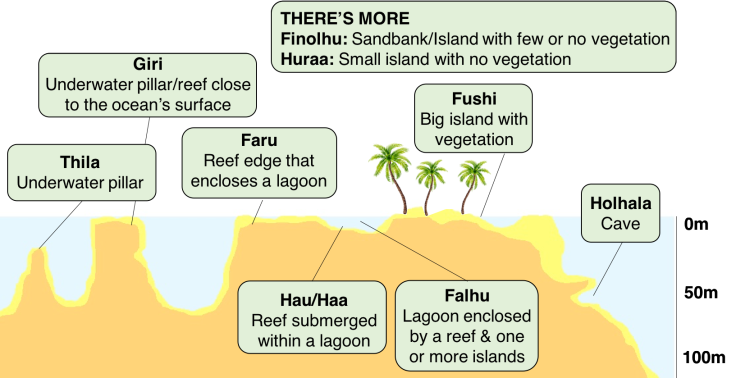
The different local names for reef and island structures
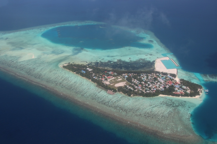
The atolls and islands of the Maldives are beautiful, but because land is scarce, more and more islands and atolls are filled up or reclaimed for the construction of resorts and residential areas. Efforts to control coral mining for building materials have been put in place for instance, and mining is not allowed on island house reefs, in common bait fishing reefs, and applications declaring the quantity of corals that will be mined must be approved beforehand. In some sense, I think this is a problem that small island states like Maldives and Singapore share in common…how can you mitigate the impact of coastal development, and what are the costs implicated? In areas that have already been developed, how can you help ecosystems to recover?
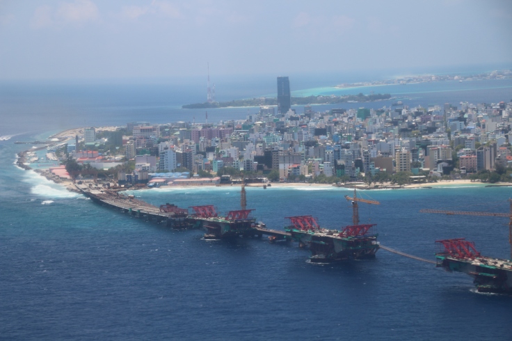 The 1.39 km long China-Maldives Friendship Bridge under construction, which will connect the capital city Malé and Hulhumalé, the neighbouring island that houses the main airport.

Man-made channels in the reef (Dhivehi: Neru)
Another way to limit the amount of damage to reefs is to create designated channels in the reefs surrounding the islands. This is quite common in many resorts including Banyan Tree Vabbinfaru and Angsana, so boats/snorkellers don’t end up getting stranded on parts of the reef that are too shallow or that they don’t end up damaging the entire reef.
I’ve been flying on the cheapest budget night flights from Singapore and Maldives that always and vice versa, so I haven’t really had a chance to see the Maldives from the air but man, I think Maldives might be one of the most beautiful countries I’ve ever seen from a plane.
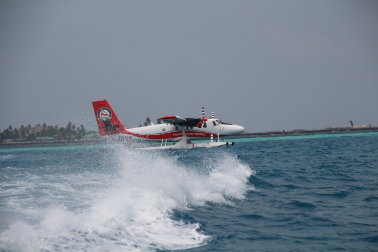
AAAAND TOUCHDOWN! HELLO VELAVARU!

Leave a comment